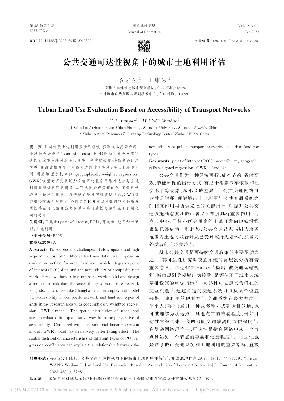
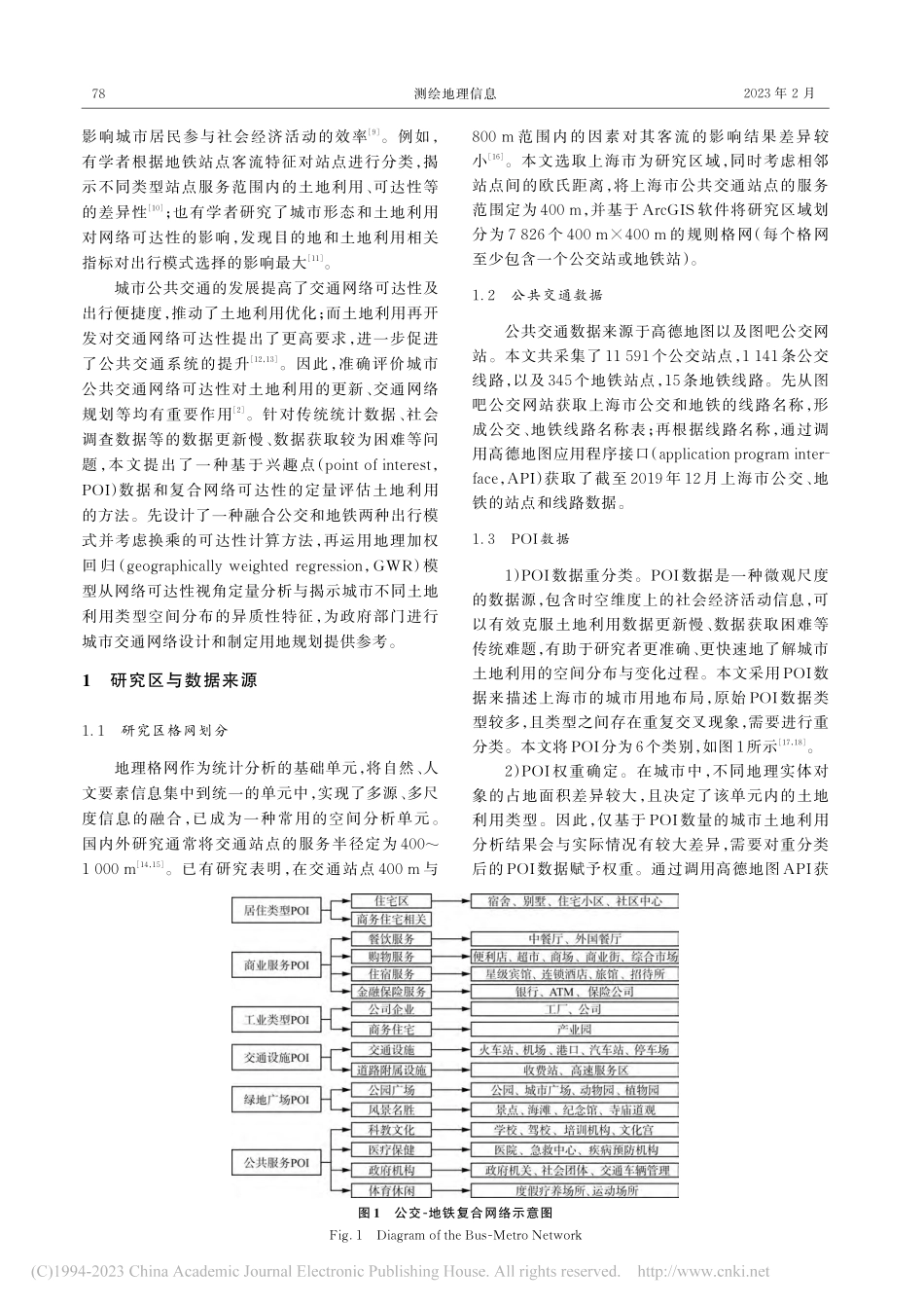
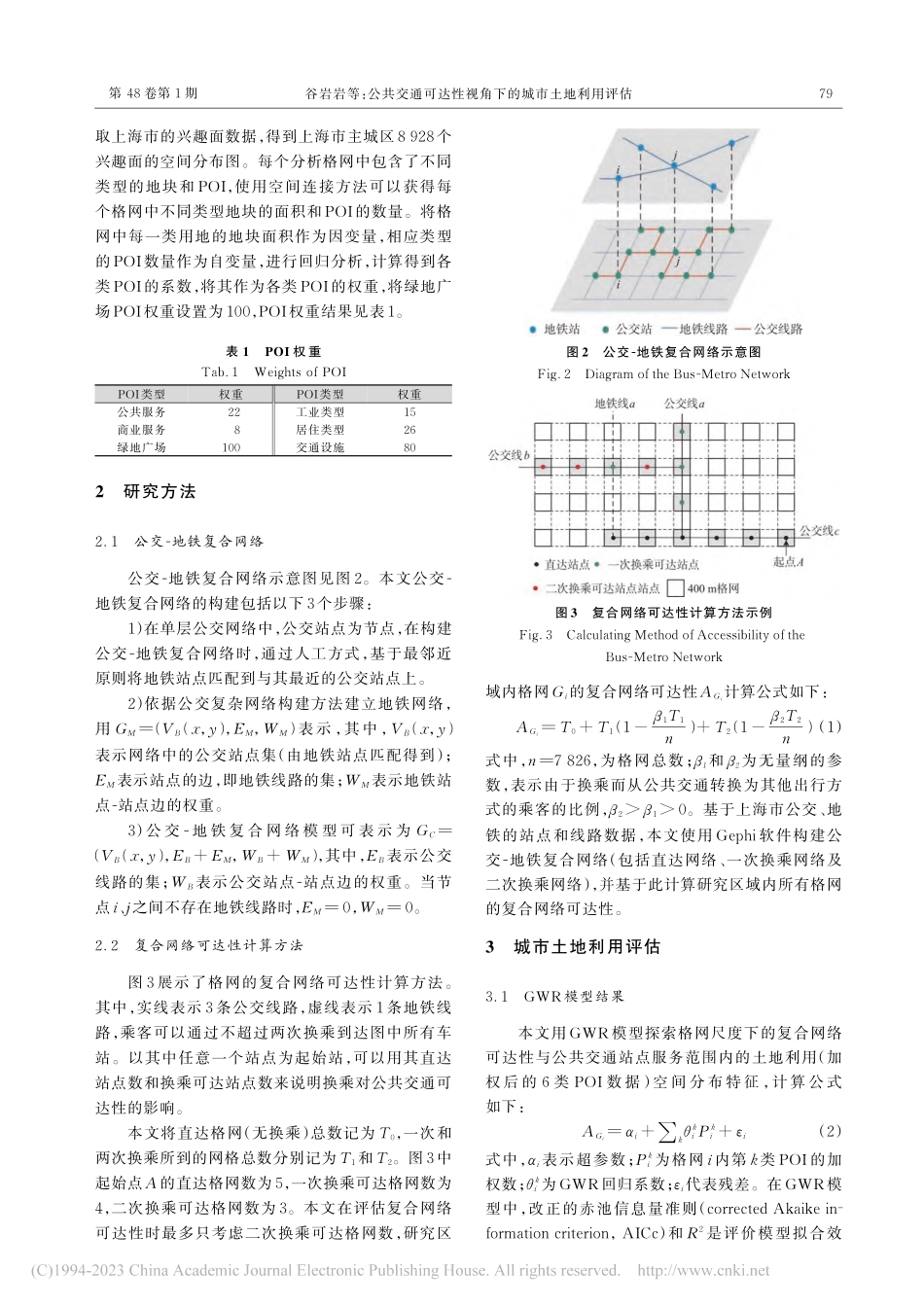
第48卷第1期2023年2月Vol.48No.1Feb.2023测绘地理信息JournalofGeomatics公共交通可达性视角下的城市土地利用评估谷岩岩1王维皓21深圳大学建筑与城市规划学院,广东深圳,5180602珠海市自然资源与规划技术中心,广东珠海,519099UrbanLandUseEvaluationBasedonAccessibilityofTransportNetworksGUYanyan1WANGWeihao21SchoolofArchitectureandUrbanPlanning,ShenzhenUniversity,Shenzhen518060,China2ZhuhaiNaturalResources&PlanningTechnologyCenter,Zhuhai519099,China摘要:针对传统土地利用数据更新慢、获取成本高等难题,提出融合兴趣点(pointofinterest,POI)数据和复合网络可达性的城市土地利用评估方法。先构建公交-地铁复合网络模型,并设计格网复合网络可达性计算方法;再以上海市为例,利用地理加权回归(geographicallyweightedregression,GWR)模型对研究区域所有格网的复合网络可达性与土地利用类型进行回归建模,从可达性的视角精细化、定量评估城市土地利用现状。与传统的线性回归模型相比,GWR模型拟合效果相对较优,不同类型POI回归系数的空间分布异质性特征可以解释公共交通网络可达性与城市土地利用之间的关系。关键词:兴趣点(pointofinterest,POI);可达性;地理加权回归;土地利用中图分类号:P208文献标志码:AAbstract:Toaddressthechallengesofslowupdateandhighacquisitioncostoftraditionallandusedata,weproposeanevaluationmethodforurbanlanduse,whichintegratespointofinterest(POI)dataandtheaccessibilityofcompositenet⁃work.First,webuildabus-metronetworkmodelanddesignamethodtocalculatetheaccessibilityofcompositenetworkforgrids.Then,wetakeShanghaiasanexample,andmodeltheaccessibilityofcompositenetworkandlandusetypesofgridsintheresearchareawithgeographicallyweightedregres⁃sion(GWR)model.Thespatialdistributionofurbanlanduseisevaluatedinaquantitativewayfromtheperspectiveofaccessibility.Comparedwiththetraditionallinearregressionmodel,GWRmodelhasarelativelybetterfittingeffect.ThespatialdistributioncharacteristicsofdifferenttypesofPOIre⁃gressioncoefficientscanexplaintherelationshipbetweentheaccessibilityofpublictransportnetworksandurbanlandusetypes.Keywords:pointofinterest(POI);accessibility;geographi⁃callyweightedreg...