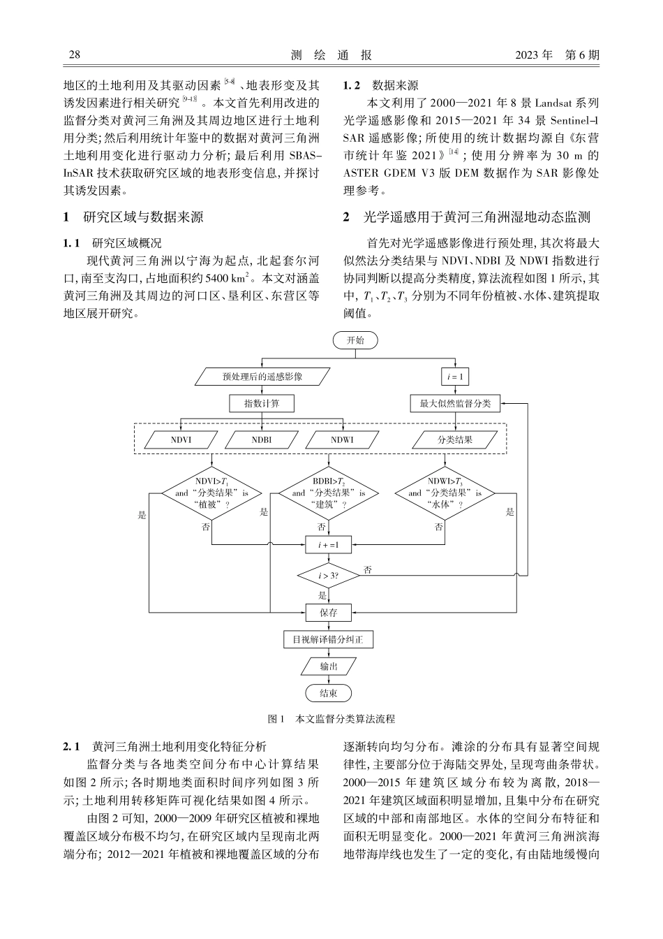
2023年第6期樊彦国,等:基于多源遥感的黄河三角洲湿地动态监测引文格式:樊彦国,王杰,樊博文,等.基于多源遥感的黄河三角洲湿地动态监测[J].测绘通报,2023(6):27-35.DOI:10.13474/j.cnki.11-2246.2023.0164.基于多源遥感的黄河三角洲湿地动态监测樊彦国1,王杰1,樊博文2,徐梓耀1(1.中国石油大学(华东)海洋与空间信息学院,山东青岛266580;2.哈尔滨工程大学水声工程学院,黑龙江哈尔滨150001)摘要:城乡建设的逐步推进与自然生态环境保护之间的矛盾愈发激烈,我国对黄河三角洲湿地区域的发展高度重视,迫切需要对黄河三角洲近年来的动态变化信息进行监测、提取与分析。本文利用2000—2021年8景Landsat光学影像与2015—2021年34景Sentinel-1降轨VV极化SAR影像,对黄河三角洲湿地区域的宏观(土地利用)、微观(地表形变)信息进行提取,并结合社会经济、自然环境数据进行驱动因素分析。结果表明:2000—2021年黄河三角洲湿地区域土地利用格局未发生显著变化,但土地利用程度逐步提高;2015—2021年黄河三角洲湿地区域的地表形变程度空间分布极不均匀,最大沉降速率达-43.643mm/a,最大抬升速率为0.136mm/a;人类活动和社会经济是引起该区域地表信息变化的主导驱动因素。关键词:黄河三角洲;多源数据协同;动态监测;土地利用;地表形变中图分类号:P237文献标识码:A文章编号:0494-0911(2023)06-0027-09DynamicmonitoringofwetlandsintheYellowRiverdeltabasedonmulti-sourceremotesensingFANYanguo1,WANGJie1,FANBowen2,XUZiyao1(1.CollegeofOceangraphyandSpaceInformation,ChinaUniversityofPetroleum(East),Qingdao266580,China;2.SchoolofUnderwaterAcousticEngineering,HarbinEngineeringUniversity,Harbin150001,China)Abstract:Thecontradictionbetweenthegradualurbanandruralconstructionandnaturalecologicalenvironmentalprotectionisbecomingmoreandmoreintense,andthestateandgovernmentattachgreatimportancetothedevelopmentoftheYellowRiverdeltawetlandarea.Therefore,itisurgenttomonitor,extractandanalyzethedynamicchangeinformationoftheYellowRiverdeltainrecentyears.Inthispaper,macroscopic(landuse)andmicroscopic(surfacedeformation)informationoftheYellowRiverdeltawetlandregionisextractedandanalyzedbyusing8-viewLandsatopticalimagesfrom2000to2021and34-viewSentinel-1downscaledVVpolar...