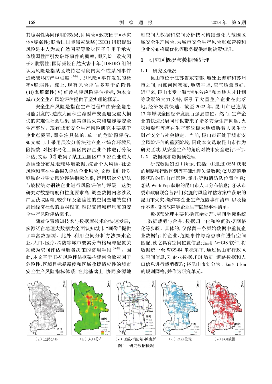
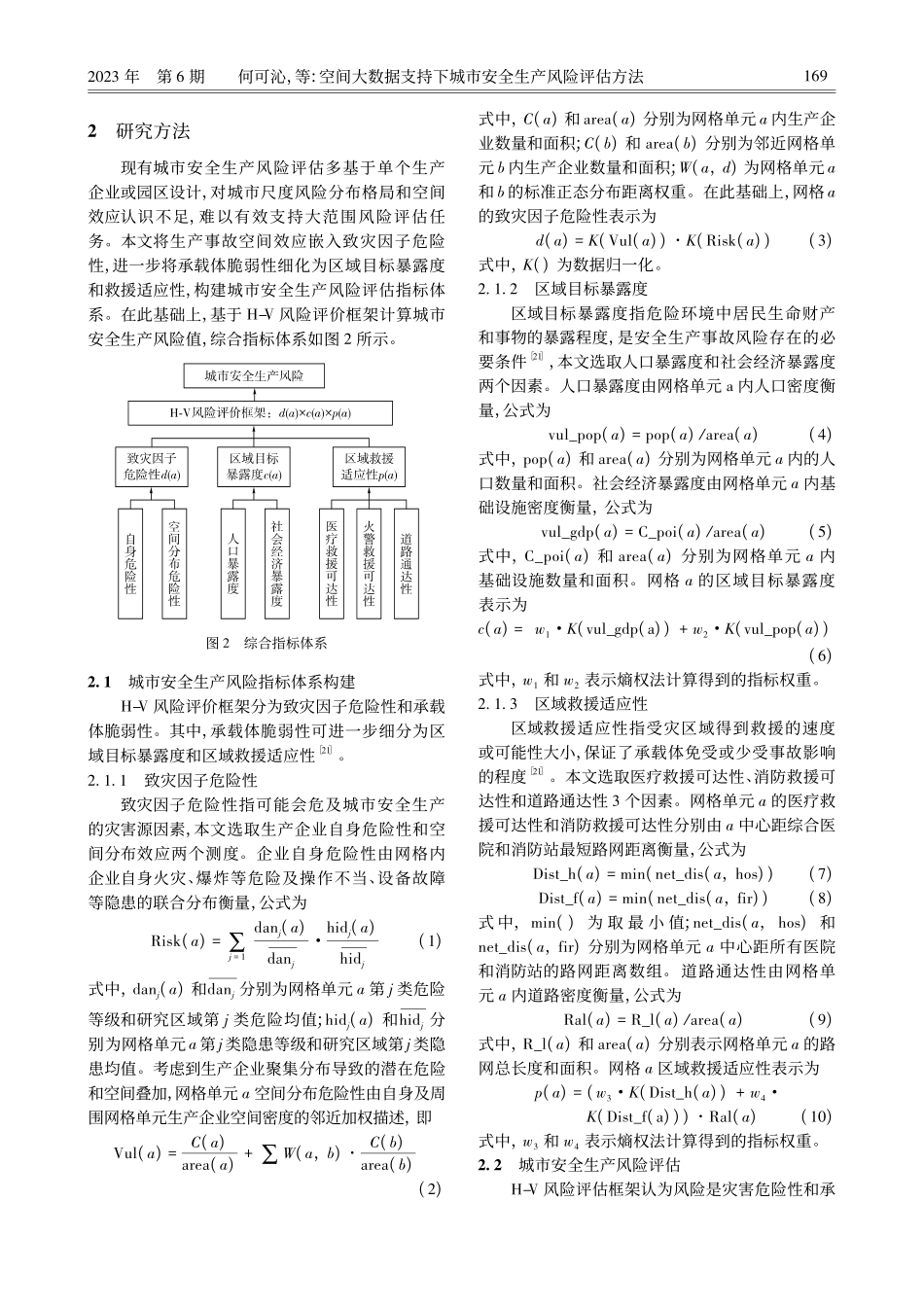
2023年第6期何可沁,等:空间大数据支持下城市安全生产风险评估方法引文格式:何可沁,程南炜,邓敏.空间大数据支持下城市安全生产风险评估方法[J].测绘通报,2023(6):167-171.DOI:10.13474/j.cnki.11-2246.2023.0188.空间大数据支持下城市安全生产风险评估方法何可沁,程南炜,邓敏(中南大学地球科学与信息物理学院,湖南长沙410083)摘要:现有城市安全生产风险评估研究大多基于统计调查数据微观地评估单个企业或园区,没有充分考虑安全生产事故空间效应,难以适应于城市尺度安全生产风险评估。本文基于H-V风险评估框架综合分析区域致灾因子危险性、区域目标暴露度和区域救援适应性等多个方面,构建城市安全生产风险评估体系,在多源地理空间数据支撑下量化分析城市安全生产风险指标,揭示城市安全生产风险分布格局,为城市安全生产防控与治理提供决策知识服务。以昆山市为研究区域,实现空间大数据支持下的城市安全生产风险评估。试验结果表明,昆山市安全生产高风险区域主要集中于玉山镇东部和南部,其中玉山镇南部致灾因子危险性较高,玉山镇东部致灾因子危险性与区域目标暴露度均较高。关键词:地理大数据;城市安全生产;风险评估中图分类号:P208文献标识码:A文章编号:0494-0911(2023)06-0167-05UrbansafetyproductionriskassessmentsupportedbyspatialbigdataHEKeqin,CHENGNanwei,DENGMin(SchoolofGeosciencesandInfo-Physics,CentralSouthUniversity,Changsha410083,China)Abstract:Mostoftheexistingstudiesonurbansafetyproductionriskassessmentarebasedonstatisticalsurveydatatoassessasingleenterpriseorpark,andwithoutsufficientlyconsideringthespatialeffectofsafetyproductionaccidents,whichisdifficulttoadapttotheurbanscalesafetyproductionriskassessment.BasedontheH-Vriskassessmentframework,thispaperconstructstheurbansafetyproductionriskassessmentsystembycomprehensivelyanalyzingregionalhazardfactors,regionaltargetexposureandregionalrescueadaptation.Withthesupportofmulti-sourcegeospatialdata,theurbansafetyproductionriskindexisquantifiedbasedonspatialanalysistorevealthedistributionpatternofurbansafetyproductionrisk,whichcouldprovidedecision-makingknowledgeserviceforthepreventionandcontrolofurbanproductionsafety.TakingKunshanasthestudyarea,theurbansafetyp...